AGRICULTURE AND SUPPLY CHAIN
Orijin
A traceability platform where every farm is a GPS polygon, and every harvest record is validated against that boundary before it counts.
- PROJECT
- Orijin
- INDUSTRY
- Agriculture and Supply Chain
- STACK
- Next.js · NestJS · FastAPI · React Native · Computer Vision · PostGIS · AWS · Docker
OVERVIEW
The project
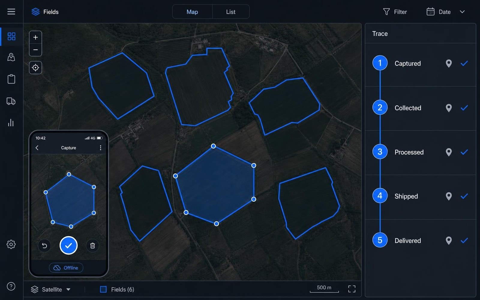
Proving where a crop came from is a data problem before it is a paperwork problem. Orijin maps every farm or production plot as a precise GPS polygon captured in the field, then validates every harvest record, quality check and survey against that declared boundary before it enters the compliance chain. The field app works with no connectivity at all and syncs once it returns.
CHALLENGE
What made it difficult
Field data gets collected where the network is not. An app that needs connectivity to record a boundary or a harvest does not get used, and paper records typed up later are exactly the weak link the platform exists to remove.
A declared boundary also has to be worth something. Without validation on the way in, overlapping or malformed polygons enter the compliance record and the traceability claim collapses under the first serious audit.
WHAT WE DID
The work delivered.
- 01
Offline field capture
A mobile app that maps each farm as a GPS polygon and queues polygons and survey data locally, syncing once connectivity allows.
- 02
Geometry validation on the way in
PostGIS validation server side, rejecting invalid or overlapping shapes and flagging anomalies before any of it reaches the compliance chain.
- 03
Satellite imagery analysis
Computer vision over satellite imagery layers, evaluated against each declared geofence to flag land use change and deforestation risk.
- 04
Location verified chain of custody
Farm, quality check, harvest and export steps each tied to a verified location, so the chain holds at every stage rather than only at the ends.
- 05
Automated due diligence reporting
Reports generated directly from verified geofence and imagery data, instead of compiled by hand for each submission.
ARCHITECTURE
How it fits together
- Offline first mobile capture with local queuing and deferred sync
- PostGIS geometry validation acting as the gate into the compliance record
- Computer vision models over satellite imagery, evaluated against declared geofences
- NestJS and FastAPI services behind a Next.js frontend, so capture, geospatial validation and reporting scale independently
TECHNOLOGY
The stack
- Next.js
- NestJS
- FastAPI
- React Native
- Computer Vision
- PostGIS
- AWS
- Docker
OUTCOME
What exists now.
Every step from farm to export carries a location verified record, so the traceability claim rests on captured geometry rather than on declarations
Field teams record boundaries and harvests with no connectivity, which is where the data is actually created
Due diligence reporting for frameworks such as EUDR comes out of verified data instead of being assembled manually
NEXT STEP
Tell us what you're building.
Bring us the problem with its real constraints attached. We will tell you what we would build, and what we would not.